Flash CTF - Wheel Was It?
Wheel Was It?
First look
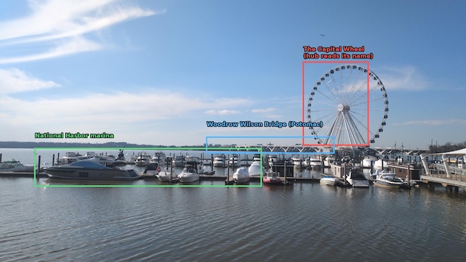
The photo is a waterfront scene: a big white observation wheel on the right, a marina packed with yachts and motorboats across the middle, and a long, low bridge in the background. The title "Wheel Was It?" is a pun on "where was it," so the wheel is the intended anchor.
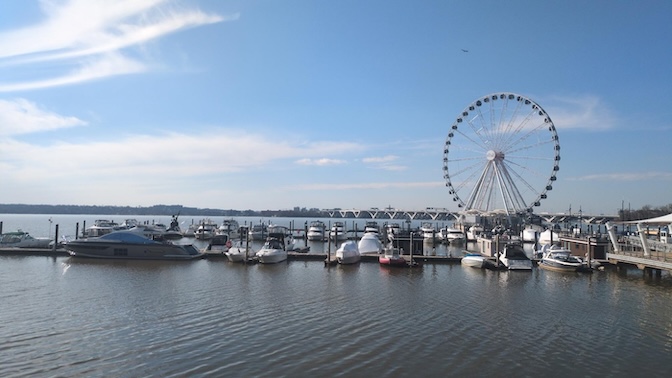
First I checked the free win — image metadata. Running the file through an EXIF reader showed the GPS and camera tags had all been stripped, so there's no coordinate to lift. This has to come from the pixels.
Reverse image search (the fast path)
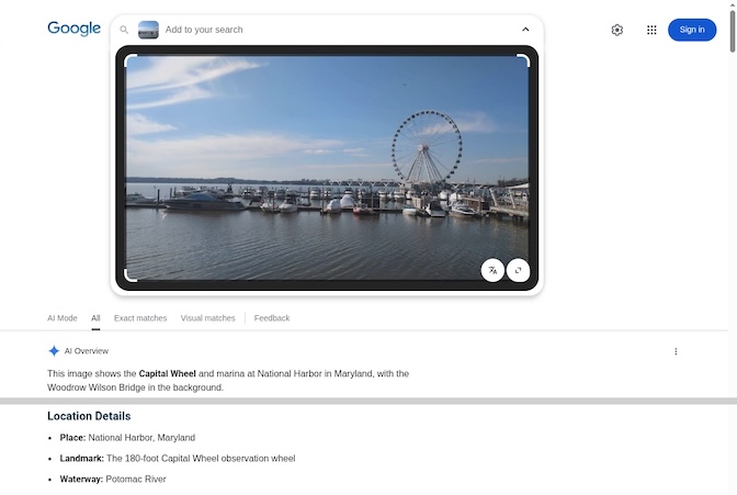
Rather than squint at the wheel, I let a reverse image search do the identification. DuckDuckGo doesn't offer search-by-image, so I used Google Lens (in a real browser window — headless attempts just get bot-walled). Lens matched it immediately and its summary spelled the whole scene out:
"This image shows the Capital Wheel and marina at National Harbor in Maryland, with the Woodrow Wilson Bridge in the background."
Place: National Harbor, Maryland · Landmark: the 180‑ft Capital Wheel · Waterway: Potomac River
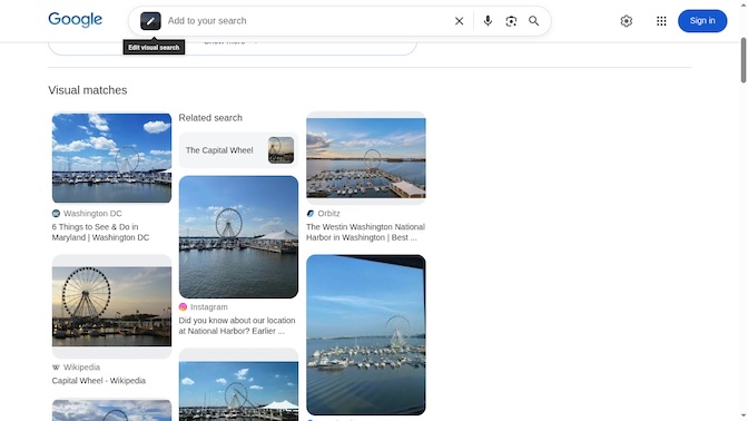
Every "visual match" it returned is the same spot — National Harbor / The Capital Wheel — from Washington DC tourism pages, the Westin National Harbor, Wikipedia, etc.:
I cross-checked on Yandex (usually the strongest engine for landmark/geo work), which independently tagged it National Harbor · national harbor maryland · capital wheel · ferris wheel:
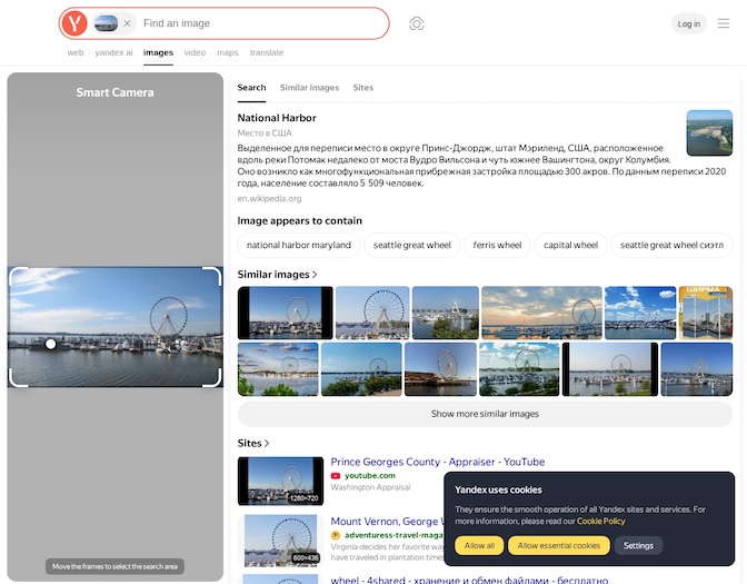
So two independent reverse-image engines agree with no reliance on reading anything in the photo: The Capital Wheel at National Harbor, Maryland.
Validation on the map
To fix the vantage I stopped doing compass arithmetic and just aligned the photo to the map by eye. The photo reads left-to-right as: open Potomac / Alexandria far bank (left) -> marina boats (centre) -> Capital Wheel (right), with the Woodrow Wilson Bridge directly behind the wheel. Rotating the satellite so the camera's view points up reproduces exactly that order. The photographer is on a floating dock in the National Harbor marina, just SE of the Capital Wheel, looking WNW (out toward the open river): the wheel is off to the right on its pier, the bridge sits just beyond it to the NW, and the boats fill the foreground. Photo (top) vs. the map rotated to match that view (bottom):
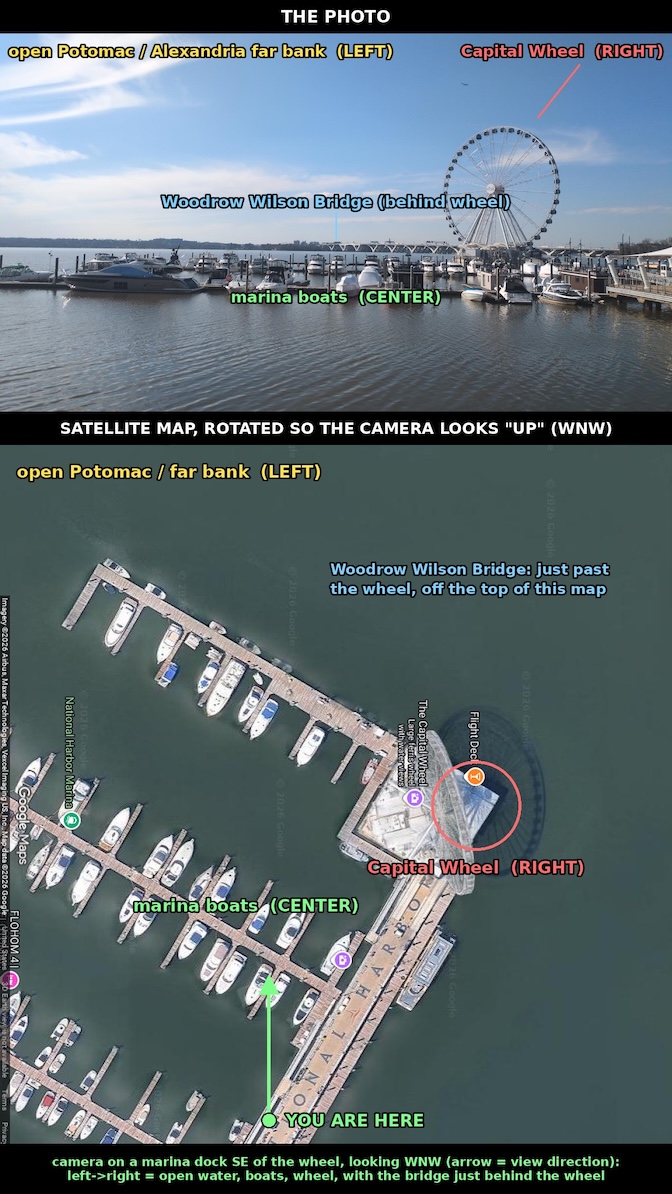
(National Harbor's waterfront has essentially no drivable Street View coverage — the deep-links only return indoor business panos — so satellite is the right tool to confirm the vantage here.)
Corroborating from the frame itself
For completeness, the photo confirms itself even without a search:
- The bridge shows distinctive V‑shaped piers and a central bascule span with green Interstate signage — the Woodrow Wilson Memorial Bridge on the Capital Beltway.

- The wheel's hub carries three lines of small text. It's near the limit of legibility at native resolution, but upscaled + enhanced it reads THE / CAPITAL / WHEEL — matching the search result:
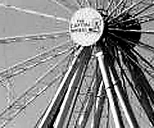
- The skyline on the far bank is Alexandria, Virginia; the boats are the National Harbor marina; and the airplane in the sky fits the Reagan National Airport approach that follows the Potomac past here.
Flag
The common name for the location is:
National Harbor